Carson City Scene

BCI is coordinating a week of cycling and adventure in and around
Carson City, Nevada from May 23rd to 30th, 2025.

As plans develop they will be posted here but plan on an 8 hour drive to Carson City,
or fly to Reno in 4 1/2 hours with 1 connection (23 miles from Carson City = 1.5 hour with RTC bus)
(potentially with bicycles and luggage hauled up by trailer)
Dreamed up by the wonderful experiences of BCI Member Mark Shapiro, we already have 50 rooms reserved, at two adjacent hotels with plans for various rides and hikes in the area, and a chance to explore one of the nicest parts of Nevada.
For details, reach out to Mark at markshapiro.email@gmail.com

LODGING:
(Click the blue hyperlinks below for your discounted reservation directly with the hotel)
Hampton Inn & Suites $143/night + tax including Hot Breakfasts
My Place Hotel; $109/night + tax including Cold Breakfasts

Book your rooms NOW!
72 hour fully refundable, but to lock in these rooms and discounts today!

Lake Tahoe is a 25-minute drive away or a 1,700 elevation cycling climb with lunch atop, shoreline trails, great hiking spots.

If you have an RV, there is public street parking on the cul-de-sac between the two hotels; No hookups but if self contained you can park there. Those wanting to stay in their RV can easily find full-service utility spots nearby.

AFTER YOU HAVE LODGING BOOKED, Register with BCI HERE

This located only a few miles from the hotel and on nice route.

Those who enjoy cycling in town can explore the tree-lined streets around the Kit Carson Trail, featuring more than 60 historical landmarks. The nearby V&T Trail is another popular ride, taking cyclists along a section where the old railroad once ran and into Longview Ranch Trails, weaving through quiet neighborhoods and past parks and playgrounds. On the eastern side of the city, the Linear Park Trail takes riders along a paved multi-use path that extends from Governors Field to Moffat Open Space and on to the Mexican Ditch Trail. Click here for all trails. 

More advanced bike routes close but outside of Carson City include the Franktown Loop, which offers a scenic ride through estate- and farm-lined roads, Kingsbury Grade, a very challenging climb to Lake Tahoe with stunning views along the way, and the ride from Carson City to Virginia City, with a steep climb that leads to this famous old mining town. 
Visit Carson City .com A hundred different things to do!

Weather Forecast:
Weather.com, click & scroll ahead to the month of May:

Examples of local rides:
Bikemap Rides
Komoot routes

We will have many short, medium, long, extra-long, and hill challenges to choose from each day, more routes/day than we can ride.
(We will be putting together BCI routes and cue slips)
Weather permitting, all organized rides and hikes will start at 9am (unless otherwise specified), designated rest stop and lunch stops either on the road or back in town.

Plan for warm weather, cold weather, and rainy weather.  A basics list of what to pack/bring will be provided. Projected weather at the end of May is 73-75 degrees days, 45-degree nights.

Carson City elevation is at 4,600 feet elevation.

Dinner-N-gab each night at a restaurant with a private room area, attendance is of course optional.  (Location, day, and time TBA). A curated list of other places for food will be provided.  For those that don’t want to bike or hike each day (or for more afternoon fun), a list of attractions and things to do will also be provided

Maps & Resources to get an idea of what is in the area:

CARSON CITY/DOUGLAS COUNTY TRAIL GUIDE (PDF)
ASH TO KINGS TRAIL MAP (PDF)
CARSON CITY MULTI-USE ROUTES MAP (4TH EDITION)
CARSON CITY MULTI-USE ROUTES TIPS & INFO (4TH EDITION)
HISTORIC VIRGINIA & TRUCKEE TRAIL MAPS

Eateries and Group Dinners with private room, schedule TBA:

• Red’s Old 395 (BBQ, salads, etc.)
• San Marcos Grill (Mexican)
• Great Basin Brewing Co (lots of options)
• Flavors of India (Indian)
• Juan’s Mexican Grill
• Nashville Social Club (music & dinner hosted, except alcohol)

Daytime-only nibbles

• LA Bakery (7am- 4pm)
• Comma Cafe (trendy breakfast/lunch (7am - 4pm)
• La Tapatia (Mexican Ice Cream, (noon to 8:30pm)
• Old World Coffee Roasters (7am - 5pm)

Lunch / Dinner other choices

  • Sassafras (eclectic)

  • Sumi Sushi

  • Poke Bowl (create own Japanese - take out)

  • Yang’s Kitchen (Chinese)

  • Vino’s Pizza (high end great)

  • Thai Basil (Thao)

  • Bully’s (bar food)

  • Pho Country (close to hotel-great vietnamese)

  • Cucina Lupo (Italian)

  • Soups (soups/sandwiches/salads/ice cream)

  • Carson Tahoe Health Hospital Cafeteria (Great salad bar & huge

    sandwiches, very reasonable $.

Breakfast (Other than free breakfast at the hotels / lunch spots if not on the route:

  • Starbucks close to hotels

  • So Juicy Juice & Salad Bar shakes, fresh juice, acai bowls, salads)

  • Squeeze Inn (huge portions)

  • Cracker Box (old style diner)

  • Eve’s Eatery (high end/trendy)

  • Paul Schat’s Bakery (fresh made pastries/bread, sandwiches, salads)

  • Carson Tahoe Health Hospital Cafeteria (best kept secret for low cost large great breakfasts)

Libations:
• Bank Saloon (quiet with live music - chill style)
• Shoetree Brewing (noon to 9pm)

More Fun things to do

  • Waterfall hike @ west end of King St (3 miles from downtown)

  • Historic walking tour of charming westside of Carson City, Kit Carson Trail

  • Multiple hikes of various levels

  • Sol Dispensary Tour (for those not doing the bike route rest stop)

  • Yoga sessions with Nichole

  • Carson Hot Springs (cemented pools, bring towel)

  • Gambling at the local casino

  • Lake Tahoe (30 minutes to a beach), Sand Harbor Beach State Park, Roundhill Beach

  • Drive to Reno, create your tour or the Classic Car Museum, walk the Truckee Riverwalk or kayak (serious whitewater depending on Winter snowfall),

  • NV Museum of Art,

  • Midtown Reno Neighborhood, restaurants.

GENOA & SURROUNDING AREAS

Eatery’s:

Questions? Contact Mark@BikeIrvine.org!

Breakfast/lunch:
• Sierra Chef (tables are outside)
• Great designer foods/pastries
• Pink Door
• Grover Hot Springs State Park (CA) - outside Markleeville (south of Genoa)

It will be the Memorial Day week,
so book your room now,
72-hour free cancellation policy
!

SB 1216 pushing (PASSED - now on Governor’s Desk) through Sacramento to reduce funds for Class 3 routes and Bike Boulevards so more money can go to Cycle Tracks

At its heart this bill is pure social engineering; it is motivated by activists who want to take travel lanes from motorists and install badly engineered segregated lanes which increase risk at driveways and intersections. It is not, in my opinion, pro-bicyclist but anti-car.

Please read the text in CABO's position paper and consider for yourself what type of facilities are worth your tax money.

Understanding California Bike Lanes

Bill Sellin, BCI Ride Coordinator and also serving on the
Infrastructure Review Committee of the Orange County Bicycle Coalition
and as the Area Director of CABO for Caltrans District 12,

The California Highway Design Manual defines the Class II Bikeway (Bike Lane).
“Provides a striped lane for one-way bike travel on a street or highway.”
CA HDM, Chapter 60, Topic 62.1(2)
They are NOT obstructed with any barrier or divider from traffic lanes - there is no such thing in California as a “Protected Bike Lane” - those are Class IV separated Cycle Tracks.

Pavement MARKING
Bike Lanes are marked with a standardized symbol and directional arrow. Below is the current ‘Best Practice” Complete Streets format suggested by the Department of Transportation. The helmeted bicyclist symbol (facing traffic not the gutter), and a directional arrow reminding that they are one-way and usually with traffic, and on a green background to be highlighted even when no cyclist is present.

This is the best choice of the 3 standard options:
A is a bicycle symbol, B is the bicycle rider with helmet and C is BIKE LANE in english

The National MUTCD has deleted Option B - The CA MUTCD may also drop it in the 2026 Revisions to match the National Standards...

No longer supported by the MUTCD
(National or California)

In Irvine, we don’t see the green backing yet, and still see some bike lanes marked with the 1970s standard “BIKE ONLY” - which was rejected across California as it dissuaded motorists from using Bike Lanes as they should to turn right from. Motorists are legally required to merge into the bike lane before turning right to avoid the common right hook crash. This is true in every state but Oregon. Large vehicles can’t pull this off, so always watch wide turning trucks…and some places the bike lane is way less than the 6 foot minimum on streets over 40 mph so it just won’t work (ie University WB to Culver NB). The Orange County Highway Design Manual calls for 10 to 8 foot bike lanes. The State minimum is 4 feet at 40 mph or less, 5 feet with a gutter & curb, with 3 feet between the stripe and the edge of the pavement & gutter pan, or 6 feet when the speed of traffic is over 40 mph.

We also see BIKE LANE in some places, and in some locations where a contractor uses the incorrect direction of the Fig. B marking: facing the gutter. That WAS standard in the MUTCD from 2003 to 2010, but no longer.

SIGNS Bike Lanes have a special sign: A white sign means it is regulatory and has laws in the CVC about it. That is why California has it’s own white BIKE LANE sign designated R81 (CA) which is different from the Federal standard R3-17 with a black background:

In most places, parking is not allowed in a bike lane, so there are also special R7-9 signs to remind motorists who might look to park there.

WIDTH and STRIPING Bike Lanes are only helpful when they are wide enough to ride in. Typically a cyclist needs 4 feet of operational space to ride. California standards call for a MINIMUM 4 foot wide Bike Lane except adjacent to on street parking - then a minimum of 5 feet, or when posted speed limit is over 40 mph then a minimum of 6 feet. When there is a concrete curb & gutter, the minimum width is 3 feet from the bike lane stripe to the joint between the pavenet and gutter pan - both so we won’t clip a pedal on the raised curb and also to reduce the need to ride in the gutter. The joint between the asphalt road surface and the concrete gutter pan of a standard curb can be a lateral hazard and gaps or uneven surfaces there can cause a crash.
”As grades increase, downhill bicycle speeds can increase, which increases the width needed for the comfort of bicycle operation. If bicycle lanes are to be marked, additional bike lane width is recommended to accommodate these higher bicycle speeds.”
Highway Design Manual, Chapter 300, Topic 301.2 (1)
The Orange County Highway Designs Manual calls for typically 8 foot bike lanes. 11 feet with parking. Additional width when prevailing traffic speeds are over 40 mph. They can be as narrow as 5 feet if being added to an existing roadway.
Orange County Highway Design Manual, Chapter 1000, § 1003.2 (1)
Orange County Traffic Manual, Chapter XIII, B.3

The WHITE STRIPE between the Bike Lane and Traffic Lane is 6” wide. When solid, the line is described as “Detail 39” and it is OUTSIDE of the Bike Lane width. A ‘buffer’ is when a double white strip is put down. The minimum buffer of 18” means two 6” stripes plus a 4” gap = 18”. Buffers serve to highlight motorists to stay clear of the bike lane, and provide a bit of space to pass slower cyclists or avoid debris without having to merge all the way out into th traffic lane. A buffered Bike Lane is sometimes referred to as a “BBL” or “Class 2B”.

The lane line stripe is dashed before an intersection where it is required for turning traffic to merge over & turn from the Bike Lane. When dashed, this is called a Bike Lane Intersection Line and described as “Detail 39A”. This portion of a Bike Lane is called “shared”. The standard is a 4 foot dash with 8 foot gaps. With short blocks less than 40 feet the dashed line is the minimum of 50 feet. On longer blocks or with traffic speeds of over 35 mph, the length of dashed stripe should be 200 feet. Vehicles are required to merge into the shared Bike Lane at these points. They are NOT allowed to drive in the Bike Lane before the dashed line. As Complete Streets green paint is rolled out, we will se many of these shared segments striped with green 4 foot wide blocks to the right of the white dash, with 8 foot gaps. As experienced cyclists - we know to merge out of the shared lane when the intersection line starts - or sooner if traffic permits - for 2 important reasons: 1 - Safety; by signalling and safely merging out into the traffic lane we are most visible to motorists. We control the lane and keep them from right hooking across us. We give them space to do the right thing and merge into the shared bike lane to make a right turn. 2 - Courtesy; By freeing up the shared bike lane for right turning traffic, we help motorists and other road users , have the space to turn right as required without having to wait for us to go straight. Legally we can stay in the shared bike lane, but that invites right hook overtaking by impatient traffic and holds up others who may more patiently wait behind us to make their right turn. If a motorist is doing it right, taking the shared bike lane with blinker on, scanning traffic before turning - DO NOT ‘filter up & squeeze past them in the gutter!
CA MUTCD 2023 revision, Page 1395 §20 & 21

“FILTERING UP” is the dangerous habit of passing slowing vehicles on their right, when any one of them might start to move & turn right without blinker or warning, or turn from the traffic lane instead of the shared bike lane. It is illegal to pass on the right. You are coming up on the driver’s blind side. Large vehicles can not turn from the shared bike lane and WILL turn right from the traffic lane, right hooking you. Many cyclists have been killed ‘filtering up’ on the right of moving vehicles. It also means if you come to a stop, you are now blocking the right turn option of other road users - including cyclists, who want to turn right, as they should, from the shared bike lane.

AT RIGHT TURN ONLY LANES Bike Lanes have 3 options:
1: The Bike Lane will END and we are expected to shoose the traffic lane going in our direction; Either stay to the right and use the right turn only lane (RTOL), or merge left to the through traffic lane. When the Bike Lane is ending, signal and safely merge out as early as traffic will allow.
2: The Bike Lane will be extended left of the RTOL and you will be expected to safely weave left in the conflict zone across traffic that is weaving right to the RTOL. More of these are getting Complete Streets green treatment to highlight the conflict zone. Again, either stay to the right and use the RTOL, or merge left to the extended Bike Lane. When the Bike Lane weaves left, signal and safely merge out as traffic will allow. There may be a R40-4 sign supporting the weave that tells traffic to BEGIN RIGHT TURN LANE ~ YIELD TO BIKES but always check and expect traffic to not see you.
3: In some places, the bike lane ends - maybe even with a conflict marking - into the RTOL. The sign that says RIGHT TURN ONLY may have a R118 (CA) sign added that authorizes you to stay in the RTOL even though you ar egoing straight. There may also be Sharrows painted near each right turn arrow on the pavement which authorizes ignoring the right turn controls and going straight. With out the sign or the sharrow, see #1 - it is illegal to proceed straight from a RTOL.

To go straight at a RTOL, take the green path of travel. To turn right, control the RTOL and turn right.

MANDATORY USE Using Bike Lanes is required by law, but with many exceptions including if we are moving as fast as the normal speed of traffic at that time

California Vehicle Code 21208

(a) Whenever a bicycle lane has been established on a roadway pursuant to Section 21207, any person operating a bicycle upon the roadway at a speed less than the normal speed of traffic moving in the same direction at that time shall ride within the bicycle lane, except that the person may move out of the lane under any of the following situations:

(1) When overtaking and passing another bicycle, vehicle, or pedestrian within the lane or about to enter the lane if the overtaking and passing cannot be done safely within the lane.

(2) When preparing for a left turn at an intersection or into a private road or driveway.

(3) When reasonably necessary to leave the bicycle lane to avoid debris or other hazardous conditions.

(4) When approaching a place where a right turn is authorized.
Including every driveway!

(b) No person operating a bicycle shall leave a bicycle lane until the movement can be made with reasonable safety and then only after giving an appropriate signal in the manner provided in Chapter 6 (commencing with Section 22100) in the event that any vehicle may be affected by the movement.
WE should to signal and yield as we merge out of a Bike Lane to the traffic lane.

Should Irvine convert Bike Lanes into Cycle Tracks or add buffers ?

Member Rick Levin shared this photo October 20th: of the ‘progress’ on Cadence in the Great Park.
Class 2 Bike Lanes being replaced with Class 4 Cycle Tracks by the City of Irvine.

Opinion and Call to Action by Bill Sellin, Ride Coordinator and also serving on the
Infrastructure Review Committee of the Orange County Bicycle Coalition and as the
Area Director on the California Association of Bicycle Organizations for Caltrans District 12,
City staff, politicians, their appointees and many of their constituents are fully enthused about going with ’protected bike lanes’ all over Irvine.
Bill thinks they create more problems than they avoid; trading a fear of traffic without understanding that being visible and part of traffic is safer than being separated and then placed in conflict with traffic.

The City of Irvine Transportation Committee will be hearing comments and staff reports on the plans to narrow travel lanes on Irvine roadways to calm traffic and allow space to add buffers to existing bike lanes or remove the bike lanes and instal cycle tracks at their regular meeting on September 3rd.

Motorists may be there to loudly complain about any attempt at slowing down their vehicles, and cyclists who are afraid of bike lanes will clamor for ‘protection’ but there needs to be voices of cyclists who don’t want cycle tracks to also be heard -
PLEAsE attend and support narrowing travel lanes, but ask the city be realistic about Class 4 vs Class 2 bikeways.

Class 2 Bike Lanes are subject to the CVC and are mandatory use.
The State minimum width is only 3 feet between the edge of the gutter pan and the stripe. The County standard calls for 8 to 10 feet which works better for right turning traffic to use it. ”Buffered” Bike Lanes (BBL or “Class 2B”) are those where extra paint has been added as an island between the bike lane and the travel lane. Painting a buffer helps make the bike lane more obvious to motorists, but still allows us to merge out to pass slower traffic, to avoid hazards and debri, and to clear the ‘gutter lane’ at intersections and driveways where right turning traffic might overtake and ‘right hook’ us.
We may use the buffer to pass or ride in, but vehicles are not supposed to drive on them except when turning or parking, and hopefully yielding to us if and when they see us …
We are seeing new buffers added on many street in Irvine over the last year.
The California DOT says a minimum buffer can be as narrow as 18” (1.5 ft) and the long standing buffer on University (see picture below) is a full travel lane width. The buffer may also be painted in the door zone of parked cars when a painted as Door Zone Bike Lane (DZBL) - or on both sides of the bike lane as a Double Buffered Bike Lane (DBBL).

Class 4 Cycle Tracks (“separated bikeways”) are seperated with obstacles from bollards to curbs to lines of parked cars. (see pictures of local examples below) They promise more “comfort” from traffic but they create real hazards. They look great mid-block - which is how they alway picture them, but the intersections, driveways and actual movement are problems unless there are just well spaced bollards that we can weave in and out through:
You can not escape to the travel lane to pass a slower cyclist in the cycle track, or to avoid debri, glass, or other hazards if the barrier is solid as proposed on South Yale.
You can not merge left to the travel lanes to make a left turn as we do from bike lanes.

Without complete intersections, or traffic circles at every intersection, they are keeping us in the far right gutter lane when regular traffic may turn right - setting us up the classic and common ‘right hook’ crash that we avoid by merging out of the gutter lane where vehicles might turn right.

The traffic on a road, and street sweeping clears bike lanes of small debri, but a cycle track does not benefit from the regular traffic wind and regular full sized street sweepers can’t fit - so Irvine will have to invest in a special narrow street sweeper that may sweep out gutter lane less…

California has 4 classes of bikeways: Class IV is the newest option…

Typically disingenuous ‘marketing’ graphic showing all 4 classes of bikeways under California law. It shows a Class 1 side path, set back at least 5 feet from the street and with 2 foot clear at grade shoulders on both sides… shows a worst case Class 2 DZBL, A Class 3 Bike Route (not all get sharrows marked on them - Laguna Canyon Highway 133 is a Class 3 Bike Route) and the class 4 cycle track. Extend these mid-block views to intersections, driveways and multi lane roads and you could see better how they really compare… and the problems with Cycle Tracks in most locations.

Source: https://issuu.com/katreyes/docs/pa795_finalcapstone_spring2021_equityincycling_wit/11citing Caltrans as the source of this graphic. The Class II / 2B - 2B indicates ‘buffered’ : BBL although the image shows a worts case DZBL with no buffers.

Examples across Orange County:

Class 2 BBL Irvine - Southbound University Avenue is a 4 lane road but the south bound side was built wide enough for 3 lanes; the bike lane is buffered with the widest buffer we know of. Of course, being in Irvine, the bike lane is wider than the State 6 foot minimum, there are no Bike Lane signs to be seen, and the posted speed limit (despite the curves and the bike lane) is sparsely posted at 55 mph.

Class 2 DBBL Irvine - Hearthstone was a 3 lane road with standard bike lanes but some time before Jan 2019 on-street parking was added on the northbound side and the bike lane took the space of the NB #2 travel lane: It is a Double Buffered Bike lane (DBBL) - with the space between the bike lane and the travel lane diagonally hatched as a typical buffer, but also has a buffer between the bike lane and the parking lane. This keeps cyclist out of some of the ‘door zone’ and is the best option for a door zone bike lane (DZBL), although the door zone should be at least 3 feet and the bike lane is wider than needed inviting confused motorists to occasionally drive in it. Of course in addition to the dooring hazard, each parked car must merge across the bike lane to park or pull out, but the cyclist is visible to motorists driving alongside, rather than hidden behind the parked vehicles. Irvine, so no speed limit or Bike Lane sign is posted. The old BIKE ONLY marking is being replaced with current standard markings as streets are being resurfaced.

Class 2 BBL Newport Beach - MacArthur Boulevard Newport Beach is way ahead of Irvine in adding buffers to existing bike lanes; these buffers were added before June of 2017 and look about 3 feet wide. Note how despite the buffer, vehicles still drive in the right half of their very wide travel lane, right along the buffer. Narrower travel lanes make room for a wider buffer and calm traffic speeds. Posted speed here is 60 MPH despite the bike lane. Because there ar eno driveways and few intersections, some of this segment might warrant consideration of a Clas s4 - but why? Every intersection would require shifting to a Class 2 and the sidewalk option should make a ‘comfortable’ option for the traffic averse. (Newport Beach, unlike Irvine, PROHIBITS cycling on sidewalks EXCEPT when, like here - the wide sidewalk is designated as a sidepath “Bike Route”.


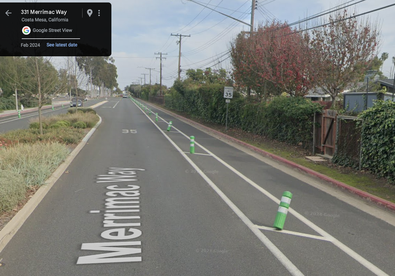
Class 4 w/BOLLARDS Costa Mesa - Merrimac Way was a 4 lane street with a minimum standard bike lane - now a 2 lane street with a bollard separated cycle track. Speed has remained at 35 mph. Costa Mesa has not yet removed the old tiny sized Bike Lane signs, even though this is no longer a bike lane. CalTrans has still not come up with a sign to post on a Cycle Track.

Class 4 w/ISLANDS Santa Ana - Bristol Street had 6 wide travel lanes and a wide sidepath but despite many intersections and driveways, all 3 travel lanes were narrowed to fit in a narrow island with a separated Cycle Track. Note that that island has a gutter pan on BOTH sides so the pavement between gutter pan joints is less than 3 feet. Santa Ana posted new Bike Lane signs, even though this is not a bike lane. Cyclists (and eBikes) still ride with the pedestrians on the side path (wide sidewalk) and some cyclists still prefer sharing the #3 travel lane over posted 40 mph over the narrow Cycle Track.

Class 4 w/PARKING Santa Ana - Hazard Avenue had 4 lanes and on street parking. It now has a parking separated class 4 that wobbles in and out of a Class 2 buffered Bike Lane and then reduces to a 2 lane Class 3 bike route with sharrows. The parked cars are supposed to ‘protect’ the cyclists, but they are hidden and invisible behind the parked cars and a surprise at every driveway and intersection. the people that park there walk in and across the Cycle Track to reach their vehicles, and passenger side dooring is now a real concern. Garden Grove also added new Bike Lane signs even though this is not legally a Bike Lane.

Join me in
SUPPORT of narrowing travel lanes AND LOWERING POSTED SPEEDS
SUPPORT of Buffers if the width is taken from the travel lanes - NOT THE BIKE LANE
SUPPORT of keeping bike lanes 10 to 8 feet wide as the County Highway Design Manual requires, not the 6 foot minimum called for by the State of California standards on street posted over 40 MPH.

I DO NOT SUPPORT Class 4 cycle tracks for all the reasons discussed above. The cost alone could go a long way to improving pavement, curb cut width, wayfinding signage, conflict zone marking and other infrastructure that would make cycling better for all of us.


Irvine requested a letter of support on their plans for YALE:

BILL said no on behalf of BCI.

Hi Bill,

This is Derek Meksavanh from the City of Irvine. I recall in the past, Cheryl Lea reached out regarding the Yale Corridor project, including a stakeholder meeting in October 2022 (attached is a PDF for reference). I am reaching out now to request a Letter of Support for the Highway Safety Improvement Program (HSIP), administered by the California Department of Transportation (Caltrans), for the safety improvements on Yale Avenue, as determined through the outreach process. We kindly request support from BCI, as this project significantly enhances the pedestrian and bicycle environment with safety improvements.

The proposed project is located on Yale Avenue from University Drive to 350ft north of Michelson Drive (highlighted in yellow in the map below). The project area was identified as a priority through extensive community outreach efforts. Among all community outreach efforts, students and residents emphasized the importance of improved multimodal safety and connectivity along Yale Avenue. 

The City aims to apply safety countermeasures and enhance safety through improvements such as implementing landscaped buffers and protected bike lakes in each direction, a pedestrian crosswalk with new rectangular rapid flashing beacons - connecting the community paseos, restricted on-street parking near Rancho San Joaquin Middle School to improve safety, new streetlights, and bicycle crossings with the addition of dedicated signal phases for bicyclists at the Yale Avenue and University intersection, connecting the University Trail. The City aims to bring the concepts and planned designs to construction to enhance safety and connectivity, with HSIP being the next step toward achieving this.

The City would greatly appreciate BCI's support in providing a letter of recommendation for this Project's grant application. The application is due on 9/9, but we are submitting a week prior to this deadline. If this works, may we receive a signed letter by Thursday, 8/29? 

Attached, please find a draft letter for ease. Please feel free to make changes as appropriate and reach out to any of us if you have questions. Thank you again for your time and continued cooperation.

Bill Sellin, as Ride Coordinator declined in this reply:

Hi Derek,

Normally we would be happy to, and the OC Bicycle Coalition also weighs in with support, but this project is not supported.

I, for one, would rather see these competitive and limited resources better spent in a grant to another worthy project in Orange County, than see it wasted on this one.

We were asked when the demonstration was laid out, as well as at the community meeting at University Park, but our minority position in resistance to this project as proposed was not heard then, and may not now, but we would rather support real improvements in pavement quality and consistent marking of Bike Lanes across Irvine, especially at every freeway intersection, or get round-a-bouts at Yale and Yale Loop, than this plan as presented or moving forward. 

Unless there are complete intersections, the creation of narrower Class 4 cycle tracks in place of the existing wide Class 2 bike lanes is not a real safety feature.

The separation of cyclists into a narrow curb-bound path may look fine in the middle of a block, with only 1 or 2 single-file cyclists in it, but in actual use it makes it dangerous by putting cyclist out of the way - inconsequentially invisible, separated in the gutter, and the common 'right hook’ crash hazard is actually increased. 

The reason a Bike Lane is dashed at corners or extended left of a right turn only lane is to reduce the conflict zone for cyclist safety.

The last 50 feet before a corner, right turning motorist are required to merge into the shared bike lane and turn from that right most lane. 

Safe cyclists will merge out of the bike lane to give space for motorists to merge in behind and turn right when the cyclists are going straight.

Your selected image of the Cycle Track in Santa Ana in your presentation shows how obviously the Cycle Track makes right hook conflicts warrant conflict zone paint and significant trust that the cyclist is even seen by turning motorists. 

Adding a second gutter pan and reducing the Bike Lane width for a Cycle Track will make it harder to avoid road hazards, debris, pass slower cyclists or be able to merge out when desired, like to make a predictable left turn in traffic.

Riding on the pavement between the gutter pan and stripe is tight with the State’s 3 foot minimum. Reducing the existing bike lane AND taking another 2 feet of pavement away for the gutter pan of the island is a real reduction of space.

Street sweeping between the curbs may require special equipment and the light debris that now is blown along by traffic ‘wind’ will collect in the Cycle Track. 

Cyclists who start riding in the travel lane (Cycle Tracks are not subject to the mandatory use laws of Bike Lanes) will no longer be able to merge into the bikeway if they wish to between intersections.

…and then there are Irvine’s drivers of "out of class" illegal eMopeds and eMotorcycles, many with out a drivers license, who will drive down these Cycle Tracks at well over 20 mph or even against traffic as they do now in Bike Lanes - with no way to merge out to pass the bicyclists these bikeways are intended to serve.. 

We would certainly support:

• Wide painted buffers like we have on SB University; much more cost effective and could also reduce the travel lanes & speeds of motorists. 

• Having the REMOVED bicycle signal returned for NB cyclists to cross from the NB University Class 2 - and return the REMOVED signal request button that was there - would help allow cyclists to travel on the predictable and legally required correct side of the road rather than using the pedestrian crossing only available on the south bound side and then typically riding up Yale on the wrong side of the street. A short side path to get to the button out of the bike lane could be located behind the guard  rail. We would welcome the signal phasing for a bicycle cross-bike at University - but serving connection to BOTH sides of Yale from the University Biek path in Mason Regional Park.

• Splitting the Class 1 bikeway off the bridge at the north end of the segment, along with pedestrian separation. That would properly address the south bound cyclist being fed into the wrong side of the street as currently configured.

• Adding a landscaped center divider, like the ones added to slow down Michelson, rather than two islands, at twice the price.

• If Irvine really wants to spend limited fundswe would strongly support replacing the stop intersections with round-a-bout traffic circles at Michelson and Yale, as well as Royce and Yale to reduce speeds, conflict points and make safer traffic flow.
That would make it safer for ALL road users. You could even try to model a more expensive ‘Complete Intersection’.

• Making Royce and Yale a 4 way stop - with high contrast crosswalks. Or adding an on demand flashing pedestrian signal like across Michelson to the shopping center. The crossing now is unmarked and the vertical curve of Yale makes it hard to see small children crossing there now. Turning left or crossing on Royce across high speed Yale traffic, when it occurs, can be challenging for a cyclist.

• Putting a 2 way Class 1 Bike Path along the west side of Yale, in addition to the sidewalk, and in addition to the on-street Bike Lanes and complete with grade separation over University, Royce and Yale if you are serious about making Yale a primary bicycle corridor. THAT would serve the ‘8 to 80 year olds' your consultant thinks will use the corridor and provide true separation from traffic that a Cycle Track cannot accomplish. Taking some of the right of way to do this would also meet your desire to narrow the travel lanes to reduce speeding.  

We really like and feel comfortable cycling on this segment of Yale as it is, 
with wide Class 2 Bike Lanes that exceed the State Minimums and meet the Orange County Highway Design Manual 8 to 10 foot Bike Lane standard.
Reducing the width and thwarting our ability to merge into the travel lane, would be a very real detriment to our safe and legal road use. 
We would likely take the travel lane and not use the Cycle Track if this project is ever completed.

Your description of the plan as including a “Protected Bike Lane” reveals your subscription to the false marketing bias of Separated Cycle Tracks as always being better than a Bike Lane in every situation.

California Standards do not use the term “Protected Bike Lane" for good reasons. Bike Lanes have specific legal standing and rules in the California Vehicle Code that do not apply to Cycle Tracks. 

Maybe they have advantages in some specific locations, but not this one.

Attached is a comprehensive guideline on how to implement them successfully compiled by the San Diego Bicycle Coalition;

Respectfully,

Bill Sellin BCI#2
Bicycle Club of Irvine
Ride Coordinator
rides@bikeirvine.org


Here is another expert opinion: CyclingSavvy.org How-to-ruin-a-buffered-bike-lane


Nextdoor 9/23/24:
Class IV bikeways are not mandatory use like Class II bicycle lanes are, so expect to see cyclists in the traffic lane, being honked at by impatient motorists, and unable to move over into the 'cycle trap' due to the 'protective' concrete curbs... 

Do You Know Where Your Bike Is?

-by Peter Gerrard

This week, two friends—one a cyclist and the other not so much—texted me links to feature stories about the business around stolen bikes. 

The main takeaway of both: over the past few years, as bike sales soared during the COVID-19 pandemic, what had mostly been a “one-off crime of opportunity” became a well-oiled international, and highly profitable enterprise

Wired magazine’s  article reported on  “…a bicycle theft pipeline of astonishing scale.” Writer Christopher Solomon teamed with Bryan Hance of Bike Index to detail the convoluted trail of bikes stolen, disappearing, and then showing up for sale on a Facebook page. Hance uncovered the business and man behind it in Jalisco, Mexico. He also tracked down one of his “suppliers” in Silicon Valley’s San Jose. Hance estimates that, in the Bay Area alone, it’s netted the bike thieves more than $2 million since 2020. 

It's a story that almost seems unbelievable (unless you’ve had a bike lifted). And it’s a great read:

https://www.wired.com/story/silicon-valleys-fanciest-stolen-bikes-trafficked-mastermind-jalisco-mexico/

Wired magazine’s  article reported on  “…a bicycle theft pipeline of astonishing scale.”

About a week after the Wired piece, the Bay Area’s KQED aired a podcast titled “Bikes Stolen In the Bay Area Show up on Global Black Market.” Both Solomon and Hance took part in the live broadcast. The host and other guests expanded on their reporting, adding additional community perspective. And hearing bike theft victims tell their tales personalizes what it’s like to find your bike is suddenly gone.

The podcast is archived, and you can listen to it here:

https://www.kqed.org/forum/2010101906075/bikes-stolen-in-the-bay-area-show-up-on-global-blackmarket

What do riders whose bikes are stolen go through? Certainly, there’s the stages of grief (mostly, from my experiences, anger, depression, and acceptance). I’ve had three bikes filched. The first one was probably gone from my parent’s garage for at least a month before I noticed it wasn’t there. The second form my garage when I accidentally left it open all night. The third was within  a few minutes after I finished a ride and went into the house, got distracted, and saw a blur as a rider went past my back window. I felt the cold chill of certainty that he was on my bike, confirmed when I ran outside to check. 

Unfortunately, there’s also a general lack of concern from law enforcement. It’s detailed quite well in both pieces. Overall, let’s leave it at most police departments are overworked with property crime incidents even as violent crime is decreasing.

But, as I read the last paragraph, I realize how much emotional baggage having a bike ripped off carries, and how these feelings surface even years later. So, here’s my take.

There’s possibly a lack of understanding, and maybe empathy, about the monetary investments and emotional attachments riders have with their bikes.  I had a detective dismiss my inquiry about the investigation of my stolen Colnago as being less important than the theft of a laptop from a car that was on his plate. “This computer cost almost $3000,” he dryly told me. I asked him to pull up my police report and really look at the details, especially the receipt from when I’d bought it. “Oh…” was about all I got out of him.

Incidentally, I got that one back exactly a month after it was taken. I’d reported it to a stolen bikes website, and one morning I got an email that a pawn shop had inquired about the serial number. Apparently the “loan” agreement was for 30 days.

What can you do, after this prompts you to check to see if your bike is where you think you last left it?

If you’ve registered through an app or website like Bike Index or Project 529 (badged “Garage 529” in at least parts of Orange County), consider adding it to other available ones. Why? As far as I can tell, don’t assume that information is automatically between law enforcement and public databases. In fact, Bike Index confirms that, while they share data with other organizations, most of them don’t reciprocate.

Take pics of your bike, the serial number, any parts you’ve added, and you with the bike

Check to confirm your bike is included under your homeowner’s or renter’s insurance. You might have to add it as a specifically covered item.

Consider locking your bike to something in your garage that’s fixed in place. Use that lock that you don’t carry on group rides as it weighs more than the bike you bought for its light weight.

Add an Air Tag or other GPS tracking device to your bike. But if you’re alerted your bike is “not with you” or at home, think carefully about chasing after it yourself.

Last, keep in mind that pictures you post on social media often have metadata that gives GPS coordinates. Check to see if you can block this “helpful” feature. Have you noticed that Strava “hides” the start and finish points of your rides? I’m not sure if it’s totally effective, but it’s a good feature that’s automatically available.

80 People and a BBQ

June 22nd: Eighty riders & friends let the good times roll even longer than a typical BCI Saturday ride at the Annual BBQ/picnic following the Sizzling Summer Remote Rides.

Retired executive chef, Penny Poorman oversaw the kitchen staff and ensured the quality of food items that included burgers, chips, watermelon, cookies, and soft drinks. The makeshift kitchen came together in Turtlerock Community Park in Irvine.

Lucky attendees had a sneak peek preview of the new club jersey designs, which will be up for a vote in coming weeks.

If you missed this party, be sure to come next year when we kick off summer and acknowledge the Summer Solstice.

Ride With Us? A Liability Waiver Is Required!

Our popular club rides happen every week, all year long with many out-of-town “remote rides.”  Feel free to bring a guest. If you are a guest —Welcome!

You may remember when everyone used to sign-in on paper forms before every ride. There were two reasons for this. First, we needed to compile ride stats. Now we use Strava for statistics. Second, we believed our insurance carrier required it. We’ve recently learned that this isn’t the case. Current, paid-up members no longer need to sign in before rides because when we joined or renewed we signed and agreed to the ACCIDENT WAIVER AND RELEASE OF LIABILITY (AWRL).

However, BCI REQUIRES guests (non-members including expired members) to sign in and print the on-line "Ticket to Ride" and submit it at every ride. Club officers collect these tickets before the start of every ride. This “Ticket to Ride” serves as confirmation that the ACCIDENT WAIVER AND RELEASE OF LIABILITY (AWRL) has been acknowledged.

Back-up printed waivers are available for guests and expired members who happen to show up without tickets.

If you have any questions, please contact us at info@bikeirvine.org

City of Laguna Niguel - Active Transportation Plan

Invitation to June 1st bike ride in Laguna Niguel

While the promoted community ride is relatively short, it would be great if any BCI riders not riding in Irvine went by the event at 9am meetup time and gave input on our large-format engagement boards. We are interested in input from both residents and visitors that travel within the City.  

See this website promoting the project and the attached event flyer:
https://cityoflagunaniguel.org/1706/Active-Transportation-Plan

Paul Martin, PE, TE
Senior Project Manager
(949) 697-7840 

MARK THOMAS
markthomas.com

Cox Email changes

Did you recently get your email switched by COX and are changing to GMail or another host? 36 of our current members did!
Many BCI Members have gone to GMail or other options to replace their cox email out of frustration and being unable to get it working on all of their devices.

You CAN still use that old cox address to log in to TidyHQ but you may not be able to receive the regular BCI News Alerts or registration confirmations, so here is how you can update your ACCOUNT email address with our TidyHQ system to replace your old @cox.com address with one that works for you.
(Your ACCOUNT settings should update your CONTACT settings as well)

Just 3 steps:

1: Log into TidyHQ at https://bci.tidyhq.com/

Enter your email address and personal TidyHQ password as prompted…

2: Once logged in, Click the box in the upper right corner to pull down a menu & select
TidyHQ Account Settings

Click the box in the upper right corner and select TidyHQ Account Settings…

3: Enter your new ACCOUNT EMAIL ADDRESS and ‘Update” to save it.
(This is also where you can change your TidyHQ log in password)

Enter your NEW login email address and Update to save

The next time you log into TidyHQ use the NEW email address you just set up…

2024 MAMMOTH GRAN FONDO - Saturday, September 7th

We’re doing it again! BCI Members #3632 & 3329 Kim and Peter Gerrard invite you to join them at the 2024 MAMMOTH GRAN FONDO https://mammothgranfondo.com/

At Horseshoe Lake in 2023.

Imagine: the beauty of nature, accented by the sweet scent of pine trees…with excellent rest stops and support, epic views, three amazing route options, free event photos, and a rad after-party!

Chosen as a "top-ten century" bike ride by Bicycling Magazine for its "jaw-dropping vistas" and named the "#7 Gran Fondo in North America" by Gran Fondo Guide, the Mammoth Gran Fondo leaves the village of Mammoth Lakes and takes you along the spectacular eastern side of the High Sierra with awesome views of the Sierra Nevada Range, the White Mountains, and Mono Lake (for the longer riders). E-bikes are plentiful and welcome.

Routes:

Gran Fondo 102 miles
Medio 70 miles
Piccolo 42 miles
If you typically do BCI’s medium rides, you’ll probably want to do the Piccolo.


LOGISTICS

Register for the Ride: Register online by September 4, 2024. https://mammothgranfondo.com/register
As of April, the price is around $119 and it goes up $10 every month, so register sooner rather than later. No refunds are permitted, but you can request a deferment. Read the registration policies.

Book a place to stay: Consider driving up on Thursday and stay for at least 3 nights. Many of us will stay at Mammoth Village Lodge with free, underground parking. The units are fully condo-equipped and there’s a pool and several outdoor jacuzzis. These condos are conveniently at the start/finish lines and where the after-party will be. (If you stay elsewhere, expect to ride your bike to/from the event or else expect to pay for all-day public parking, around $15 bucks across the street.) 

Mammoth Village Lodge condos

Getting to Mammoth Lakes from OC: The 325-mile drive from Orange County to Mammoth Lakes takes five to six hours, depending on travel conditions. 

High Altitude Acclimating: The town of Mammoth is at 7,881’. That’s why we’ll take an “acclimation” ride on Friday, Sept 8th. The trail winds through campgrounds, past stables, the Twin Falls overlook, and loops back at Horseshoe Lake. 

Contact: - Send your name & best phone number, where you will be staying & which days you will be there so we can all get in touch with one another.
BCI Communications Director, Kim Gerrard - 949-294-4117 - kgerrard@gmail.com

PLEASE SIGN IN HERE TO SECURE YOUR MEMBER INSURANCE BENEFIT


CALORIES, EXERCISE AND DIET (repost from BCI Counts*)

"Pretend you didn't exercise at all," she said. "You will most likely compensate anyway, so think of exercising just for health improvement but not for weight loss." Diana Thomas, a Montclair State University obesity researcher

In a recent discussion with a fellow member, I proffered the point that weight loss is not the prime benefit of exercise, but rather is the prime benefit of a proper diet. My friend rebutted me and said he felt exercise was at least an equal part of weight loss, along with a proper diet. I decided to investigate the issue to confirm the facts.

If you want to learn about (and finally understand) the connection between weight loss, exercise and diet, Click Here . It's an easy read, and there's also a short video that brings everything to a clear point.

What you’ll learn about:

1) An evolutionary clue to how our bodies burn calories

2) Exercise is excellent for health

3) Exercise alone is almost useless for weight loss

4) Exercise accounts for a small portion of daily calorie burn

5) It's hard to create a significant calorie deficit through exercise

6) Exercise can undermine weight loss in other, subtle ways

7) Exercise may cause physiological changes that help us conserve energy

8) Energy expenditure might have an upper limit

9) The government and the food industry are doling out unscientific advice

10) So what actually works for weight loss?


BCI Stats:

• Using Strava, BCI's range of calorie expenditure per mile of cycling is 20 to 70 calories, with the average being about 29 calories/mile. This shows three things:

1. How efficient our bodies can be.

2. The relatively small impact exercise can have on calorie consumption. One of our top-performing female members burns only 22 calories/mile. On a 2-hour ride, the average member burns about 800 calories. One typical slice of pizza ranges from 200 to 400 calories.

3. How different our bodies can be from one another, and why it’s important to learn yours well enough so you can adapt the best plan for weight loss/control.

The key takeaways from all this:

• Physical activity is excellent for health and weight control, but is not the primary driver of weight loss. Calorie deficit is the primary driver of weight loss.

• We only have control over about 30% of our caloric expenditures, and probably less. Of that 30%, at best only 50% of it, just 15% of the total, can be controlled by exercise.

• Exercise plays a crucial role in weight management, alongside a healthy diet, by impacting metabolism, appetite, and overall health (your vitals, like diabetes, hormonal balance and healthy joints). So, keep on riding!

• Using the services of science-based professionals can be useful in attaining your healthy weight loss/control goals. Here is one’s approach to the subject: Click Here

It’s anti-intuitive, but exercise without a substantial low-calorie diet adjustment is the least effective method of losing weight. Exercise for health and eat for weight control.

Until next month,

Dick Brock, BCI Statistician

statistician@bikeirvine.org

*Dick posts updates for members on the BCI Counts page of this web site (hidden under the members only section) This was a good one from 1/31/24 we wanted to share under PaceLines so we re-posted it

COPPER TRIANGLE!

Several members joined BCI Member Maria Perkins last year in Moab and she is coordinating a trip for this August to the Copper Triangle in Colorado.

Join Us for a Cool Colorado Adventure
Hike! Road Ride! Mountain Bike! Trail Run! OR?

August 2 - 7, 2024

Cost: This 6 day plan includes the sagged Copper Mountain Triangle ride that will cost each person $160 before March 1st. After that, the price increases to $170, etc. It is put on by The Collective Events. Hotel and food (aside from what the Century provides) is on your own.

Register for the Copper Triangle: *To join this group, you will need to register for the Copper Triangle ride by June 1st, 2024 or earlier. The price is not refundable. https://www.theridecollective.com/coppertriangle.

Stay: The Copper Mountain Resort is located at the start for the first day’s ride. Other rides begin within 10 miles of the start. Currently, there is one hotel and multiple condos available at the Copper Mountain Resort which is where the ride starts. For the Copper Triangle rate at the resort, call 1-866-837-2996: Discount Code 6282.

*Schedule: *Celebrate & compare plans for the next day at a 5 p.m. happy hour each night. BYOB….and any snacks to share. We’ll meet before the August 2024 trip & Zoom too.

*Thursday Arrival: 8/1/2024 - OPTIONAL:  Many of us will arrive early to acclimate to the elevation.

Friday Night: 8/2/2023 -Arrive in Copper Mountain: Join the group at 5 p.m. for dinner.

Saturday, 8/3/2024  - Ride the Copper Triangle cycling event: 79 miles, 6500 ft of climbing: https://ridewithgps.com/routes/28967737

Sunday, 8/4/2024 - Breckenridge to Vail Pass: 46 miles, 2487 ft. of climbing. https://ridewithgps.com/routes/452283

Monday: 8/5/2024 Off (Hike or mountain bike, breakfast ride spin out, or?? Jacuzzi??– It’s your choice.)

Tuesday: 8/6/2024 – Loveland Pass Through Dillon: 30 miles, 3100 ft of climbing: https://ridewithgps.com/routes/7343548?no_redir=1

      Description: https://ridewithgps.com/ambassador_routes/192-loveland-pass-from-dillon-through-keysto

Wednesday: 8/7/2024 – Leave for home.

Ride Insurance for Tuesday & Wednesday Rides:  Purchase insurance for coverage on Sunday and Tuesday rides.

CONTACT: BCI Member, Maria Perkins – 909-319-2400 bper816@aol.com You will receive a survey and we will zoom at least twice before we leave. A training schedule is being created. Please provide your email address &  phone number so we can add you to the Copper Triangle 2023 WhatsApp.  *You will also be asked to sign Disclaimers and provide a Medical Information Form.

Irvine passes City Ordinance to try and get a handle on eBikes

In California, Electric Bicycles are limited to LESS THAN 750 watts.
Low Speed Pedal Assist will ‘help’ no more than 20 mph. (Class 1)
Speed Pedal Assist will ‘help’ to no more than 28 mph and have no throttle (Class 3)
Low Speed Throttle Bikes can go no more than 20 mph on electric power.

All the eBikes that exceed those limits, with or without pedals, are vehicles and should be registered and operated as mopeds or motor-driven cycles or motorcycles. (By No one without at least an M1 or M2 drivers license and only with a DOT Motorcycle helmet)

So be advised - if you are riding any electric bicycle and pedaling FASTER than 28 mph on a street that has a posted speed limit and traffic going faster you could get cited for speeding:

Sec. 4-7-205. - Speed.
No person shall operate a bicycle or electric bicycle at a speed greater than is reasonable and prudent under the conditions then existing, and in no event at a speed which endangers the safety of persons or property. No electric bicycle operator shall travel over 28 miles per hour on a public highway.

That does not seem to take into account a strong riders who can out-pedal the 28 mph assist, or gravity on a downhill road, or the importance of matching traffic speeds when able to… It also does not include all those eBikes that are NOT electric bicycles - Like that Super73 eBike in the picture below (Oops)

source: https://online.flippingbook.com/view/227307159/8/

Life Vitality Association visit

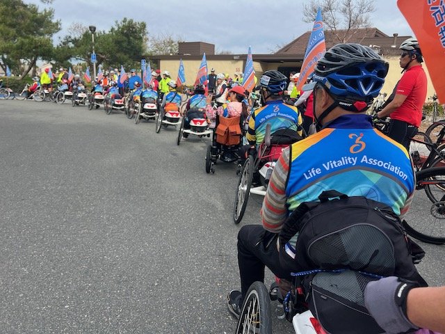
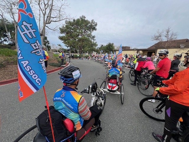
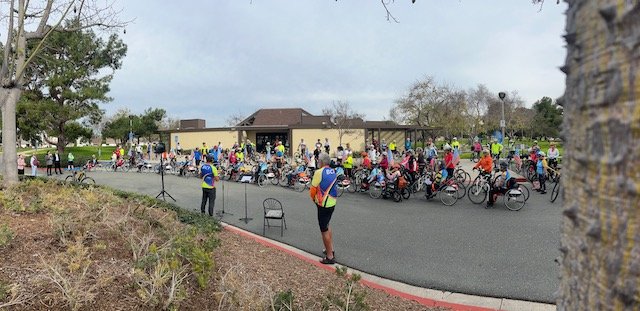
We have 20 special guests visiting from Taiwan; Below are the rides they have planned to take and anyone from BCI is welcome to tag along and help lead them on their adventure!

Jerry Chen has been coordinating the visit and Bill Sellin has been helping with routes.
We even have a glossary to explain the codes on the cue slips and ridewithgps routing to back-up the cue slips.

There are several videos on line showing what these dedicated athletes are all about!

Note: These Route slips are in kilometers

Day 1 - Feb 22 - Arriving at LAX - 14 hours from Taipei


Day 2 - Fr Feb 23 - 9am
CUES: Ride #1(&#2) - 19.5 mile Orientation Ride
ridewithgps.com/routes/45301024


Day 3 - Sa Feb 24 - 7:30am to meet BCI @ DCP at 8:30am
CUES: Ride #2(&#1) - 29.2 mile “Joining BCI Ride”
ridewithgps.com/routes/45300670
Map A: To DCP Riders and Drivers
Map B: To Coffee Riders and Drivers
Map C: To Lunch Riders and Drivers
Map D: To Hotel Riders and Drivers

Day 4 - Su Feb 25 - 9am
CUES: Ride #3 - 38.3 miles
ridewithgps.com/routes/45628132
Map 3: Bike Ride for the Riders
Map 4: Truck / Sag Stops for the Drivers


Day 5 - Mo Feb 26
Travel day to Palm Springs - Tram to play in Snow!


Day 6 - Tu Feb 27
CUES: Ride #5 - 14.1 miles - Palm Springs
ridewithgps.com/routes/45643783
Map 5: Bike Ride for the Riders


Day 7 - We Feb 28
CUES: Ride #6 - 31 miles - Palm Springs
ridewithgps.com/routes/45611454
Map 6: Bike Ride for the Riders


Day 8 - Th Feb 29
Travel Day to San Diego


Day 9 - Fr Mar 1
CUES: Ride #7 - Mission Bay to Oceanside
ridewithgps.com/routes/45610998
Map A: 0 to 7 km - San Diego
Map B: 7 to 15 km - Mission Bay to Rose Creek
Map C: 15 to 26 km - Rose Creek to UCSD (Shōwa Ramen)
Map D: 25 to 28 km - UCSD (Shōwa Ramen) to Torry Pines
Map E: 25 to 64 km - UCSD (Shōwa Ramen) to Encinitas
Map F: 45 to 60 km - Encinitas to Carlsbad
Map G: 60 to 61 km - Carlsbad Blvd @ traffic circle
Map H: 61 to 65 km - South Oceanside
Map I: 65 to 67.5 km - Oceanside to Days Inn hotel


Day 10 - Sa Mar 2
CUES Ride #8 - Oceanside to Newport Beach
(RAIN IN SAN ONOFRE AND ONLY MADE IT TO DANA POINT)
ridewithgps.com/routes/45611120
Map A: 0 to .9 km - Oceanside onto Freeway
Detail: Days Inn to Freeway Entrance (Map)
Detail: Harbor to Freeway Entrance (Arial)
Map B: 0 to 13 km - Oceanside to Las Pulgas
Map C: 13 to 16 km - Las Pulgas to Tank Road
Map D: 16 to 28 km - Tank Road to San Clemente
Map E: 28 to 31 km - Basilone to Carl’s Jr (Break)
Map F: 30 to 37 km - San Clemente Bike Route
Map G: 36 to 37 km - San Clemente Bike Route to cycle track
Map H: 41 to 43 km - Cycle track to San Juan Creek
Skipped:
Map I: 46 to 51 km - San Juan Creek to Trabuco Creek (Old SJC)
Map J: 47 to 51 km - San Juan Capistrano (LUNCH)
Map K: 56 to 59 km - San Juan Capistrano to Metrolink Station
Map L: 58 to 59 km - Camino Capistrano to Cabot
Map M: 58 to 67 km - Cabot Bike Path to El Toro (Farmer Boys / Raising Cane’s)
Map N: 64 to 65 km - Paseo de Valencia to Ave de la Carlota
Map O: 67 to 72 km - El Toro to San Diego Creek Trail
Map P: 72 km - Lake Forest to Bake Side-Path to San Diego Creek
Map P’: 72 km (Arial) - Lake Forest to Bake Side-Path to San Diego Creek
Map Q: 75 to 78 km - San Diego Creek / Sand Canyon Side-Path / Freeway Trail
Map R: 76 to 87.6 km - San Diego Creek Trail to Extended Stay America hotel


Day 11 - Su Mar 3 THEY MISSED THE BOAT BY 5 MINUTES!
CUES: Ride #9 - To Catalina Island (to and from ferry doc) TBA
ridewithgps.com/routes/45522392 to Catalina Holiday
ridewithgps.com/routes/45522438 back to OC Hotel
Map 9B: 0 to 6 km - From the boat to Hoag Hospital


Day 12 - Mo Mar 4

9:00 BCI Ride Start from the Duck Club (Bill did it)
Ride to OC Hotel before 10am: 5 miles, +137 ft CF 2
Map/Profile  https://ridewithgps.com/routes/45497983
Map 10B

10:00 Ride Start from OC Hotel
Ride to Balboa Island on the way to the San Joaquin Marsh; 15.4 miles +393 ft CF2
Map/Profile https://ridewithgps.com/routes/45498988
LVA Map 10A
#10 Santiago to Castaways to PCH to Newport Dunes
#10 Newport Dunes to Back Bay Drive


4:30 -
6:00 7:30 Farewell Dinner Reception at the Duck Club
Certificate of Friendship and Alliance ~ 友誼與聯盟證書

6:00ish Ride Start from the Duck Club
LVA Return to OC Hotel: 5 miles, +137 ft CF 2
SUN SETS at 5:51 so need to use lights !
Map/Profile  https://ridewithgps.com/routes/45497983
LVA Map 10B
(BCI Members shuttled everyone to their hotel so no one had to ride in the dark)


Final Day- Mar 5 - Return to Taiwan
5am pick up to LAX - 14 hour flight to Taipei…

The visit was a great success and everyone is safely back home - hoping BCI members will come visit Taiwan soon! Thanks to Jerry and Bill, and Dev, Marc, Ed, Tara, Bruce, Rich, Linda. Bill C., Bev, Shawn, Tommie and all the members who welcomed and helped them have a great visit.

Please watch this YouTube Video of highlights of their visit