

These are some of the routes we have used in the past for out of town remote start rides.
If you want to ‘get out of town’ on your own these may inspire you…
Click HERE to see BCI’s upcoming Remote schedule.
Click the Route Slip to get a printable .pdf file
(Date is of last version created or updated).
L & R are obvious turns, *L suggests a 2 stage box turn, but there are some obscure codes also found on them - see the route slip cue glossary HERE.
Click the Map/Profile/GPS link to see RideWithGPS for a map with elevation profile
or run RideWithGPS on your phone other device &/or upload the file to your GPS device.

Note -
RideWithGPS does provide a rough Cuesheet for each route,
but the BCI Route Slip is most accurate and will fit on 1/2 page slip…
ROADS CHANGE - THESE ROUTES MAY BE OUTDATED IF NOT RECENTLY POSTED and we can’t guarantee the route is still undisturbed by road work or new options, and we can’t assume any responsibility if you choose to follow any of them as a club ride or on your own, and the Members’ supplemental insurance does not cover you if you ride these when not scheduled by the club.
Please report any link, route or map errors to Rides@BikeIrvine.org


A series of remote rides on the 2nd Sunday of the month - Starting and ending at a different location where we can return for a lunch together. Routes have designated regroup points to hold up for the slowest riders and stay together for some tricky route details.
Remotes Listed By County…
ORANGE County


TOUR de FIVE CITIES (April 27 2019)
Ride start: Ocean Ranch Village shopping center
Trader Joe’s Parking Lot
32341 Street of the Golden Lantern, Laguna Niguel, CA, 92677 (map)
(Golden Lantern & Via Ladera)
Route Slips: 24.7 - 32.8 & 40.2 miles
24.8 miles Map/Elevation
32.9 miles Map/Elevation
40.2 miles Map/Elevation

“SIZZLING SUMMER” Remotes 2023, 24 & 25 (July 22, 2023) (June 22, 2024) (June 21, 2025) (June 20, 2026)
“WELCOME to SUMMER” 2022 (June 18 2022) &
OC Bicycle Rally 2019 (June 29, 2018)
Ride Start: Upper lot of Turtle Rock Park off Turtle Rock Drive
5 routes to choose from!
ROUTE SLIPS: (6/22/25)
(CF Rating 2 to 8 (average climb in feet per mile))
Regroup A [Short & Medium]:
Corner Bakery / Jamba Juice @ Main & Harvard in Irvine
Short: 18.6 miles (12.3), +748 ft {CF 4 40.2 ‘/m}
Map/Profile/.GPS
Medium: 25.9 miles (19.6), Rolly +732 ft {CF 2 28.3 ‘/m}
Map/Profile/.GPS
Regroup B [Med+, Long & Long+]:
Starbucks @ Alicia near Pacific Park in Laguna Niguel
Medium Plus: 30.2 miles (16.8), +1,839 ft {CF 6 60.9‘/m}
Map/Profile/GPS
Long: 43.5 miles (31.7), +3,332 ft {CF 7 76.6‘/m}
YES - CF 7 !
Map/Profile/GPS
Long Plus: 49.6 miles (35.2),+4,396 ft {CF 8 88.6‘/m}
YES - CF 8 !
Map/Profile/GPS
Orange County Bicycle Rally (Jun 10 23)
Special event co-hosted with the Orange County Wheelmen (OCW)
Ride Start: Hangar 24 Brewery
Route Slips (5/24/23) (S, M, L & L+) - OCW format
(4 pages, 2 slips per page; print the pages you want and bring to the ride!)
The 47 mile Long Plus (+2,303 ft) will roll at 8:30
Regroup at Starbucks: El Toro & Montcliff @ mile 23
{CF 4 48.9’/m}
Map/Profile/.tcx
38.6 Long (+1,398 ft) starts at 9am
Regroup at Starbucks: Trabucco & Bake @ mile 19
{CF 3 36.2’/m}
Map/Profile/.tcx
26 mile Medium (+517 ft) starts at 9:30
Regroup at Peets: Avocado & PCH @ mile 11
{CF 1 19.9’/m}
Map/Profile/.tcx
and
18 mile Short (+490 ft’) will roll at 10
Regroup at Peets: Avocado & PCH @ mile 8
{CF 2 27.5’/m}
Map/Profile/.tcx
Revised / Improved for next time…
Same Long Plus & Long, but improved / revised Medium and Short:
All 4 converted to the BCI Route Sheet Format: 2 pages, 2 routes on each.
Route Slips (6/11/23) (S, M, L & L+)
(4 pages, 2 slips per page; print the pages you want and bring to the ride!)
27.4 mile Medium (+476ft) starts at 9:30
Regroup at Peets: Avocado & PCH @ mile 12
{CF 1 17.4’/m}
Map/Profile/.tcx
and
17.8 mile Short (+490 ft’) will roll at 10
Regroup at Peets: Avocado & PCH @ mile 7.9
{CF 2 27.5’/m}
Map/Profile/.tcx
SAN DIEGO county
See also FundaySunday San Clemente to Oceanside
Deerfield to Oceanside (return on MetroLink) (May 31 2012)
Route Slip : 50.8 miles (one page pdf - print & fold in half)
Ride with GPS.com details: The Route slip covers 3 legs of RWGPG details…
Mile 0-49.2: DCP to Swami’s in Oceanside (Leg 1 - from start to Oceanside)
Mile 49.2 to 49.6: Swami's to Oceanside Station (Leg 2 - from lunch to the train))
Mile 49.7 to 50.8: Tustin Station to DCP (Leg 3 - back to the start from the train)
Start from Deerfield, ride to Oceanside - From Las Pulgas to Oceanside we will ride the freeway shoulder. (Yes - it’s legal and safe). If you have a Base Bicycle Pass you can enter Camp Pendleton from as Pulgas to Oceanside - adding a few miles, hills and missing the freeway shoulder experience.
Dana Point to Oceanside (May 18, 2024, Dec 14, 2025)
Ride start: Dana Point (map) - W3W: finds.graphic.sentences
Medium & Long+ go to Lunch at Oceanside Harbor & back by train or bicycle…
Regroup at Carls Jr for SHORT & LONG
ROUTE SLIP (12/12/25) <= All 4 options (no Base Pass required) -
Print & bring along
Short: Dana Pt to Christianitos & back - No Train
19.0 Miles +691ft {CF 3 36.4’/m} Map/Elevation
Medium: Dana Point to Oceanside & Train back to North San Clemente
Trains run North @ 11:24, 1:28. 2:35 4:28 and 5:23
34.6 miles +1,091ft {CF 3 31.5’/m}
Map/Elevation down to Oceanside Station 29.4 Miles +912 ft {CF 3 (31.0'/m)
Map/Elevation San Clemente Station to Dana Point 5.2 Miles +179 ft {CF 3 (34.4'/m)}
Long: Dana Pt to Las Pulgas & Back - No Train
39.6 Miles +1,253ft {CF 3 31.6’/m} Map/Elevation
34.5 Miles if you turn back at end of San Onofre State Beach @ Mile 16.4
Long Plus: Dana Pt to Oceanside Harbor - No Train
56.7 Miles +1,718ft {CF 3 30.3’/m} Map/Elevation
Camp Pendleton Access Options:
IF you have military access or have a Base Bike Pass you MAY take the base bike route through the base between Las Pulgas and Harbor instead of the freeway shoulder...
ON BASE ROUTE SLIPS <= Base options - BASE PASS REQUIRED
Medium: Dana Point to Oceanside (ON BASE - NOT FREEWAY) &
Train back to North San Clemente
36.5 miles +1,080 ft {CF 2 29.6’/m}
Map/Elevation: down to Oceanside Station 30.8 Miles +1,062 ft {CF 3 (34.4'/m)}
Map/Elevation: San Clemente Station to Dana Point 5.2 Miles +179 ft {CF 3 (34.4'/m)}
Trains run @ 11:24, 1:28. 2:35 4:28 and 5:23
Long Plus: Dana Pt to Oceanside Harbor & back (ON BASE - NOT FREEWAY)
59.9 Miles +2,066 ft {CF 3 34.5’/m} Map/Elevation
Most of us do not hold a current BASE BIKE PASS from the USMC, so we will ride the freeway shoulder between Las Pulgas and Harbor Drive. It’s legal, faster, shorter, safer, but noisier.
See Base Pass info here.
Ride from Dana Point to Oceanside & back
Lunch at Oceanside Harbor for MEDIUM and LONG+
Regroup at Carls Jr for SHORT & LONG
*Camp Pendleton requires a Base Bicycle Pass, only available from the Main Gate M-F.
The Freeway shoulder from Las Pulgas to Harbor is always open, legal to ride, shorter and actually safer…

Dana Point to Oceanside (April 15 2023) ( August 14, 2021 ) ( August 11 2018 )
Ride from Dana Point to Oceanside & back
ROUTE SLIP (2018 with Freeway and USMC Base options)
Dana Pt to Christianitos - 19 Miles Map/Elevation
Dana Pt to Las Pulgas - 40 Miles Map/Elevation
Dana Pt to Oceanside - 60 Miles Map/Elevation
Oceanside to Del Mar “Off To The Races” ( Oct 9, 2021 )
Ride Start: Oceanside Transit Center (Metrolink Station)
ROUTE SLIP
38.9 miles: Map/Elevation
Carlsbad / Rancho Santa Fe Remote ( November 16, 2019 )
Ride start: Carlsbad Parks & Recreation Center 799 Pine Ave, Carlsbad, CA, 92008 (map)
Enjoy the coast & hills of San Diego County: 23.5 miles to lunch in Rancho Santa Fe then return to Carlsbad with a total of 40.9 miles, or with the 58.9 mile option rolling through the Elfin Forest to Escondito & San Marcos.
Route Slips:
Out to Rancho Santa Fe - 23.5 miles
Back to Carlsbad (2 options) - 40.9 or 58.9 miles
Map / Evelevation Profiles:
Out
Back Long
Back Long Plus
Mission Bay from Old Town (Aug 20 22)
Ocean Beach, Mission Beach, Pacific Beach & Mission Bay
Ride Start: Washington Square in the Plaza of Old Town
w3w: global.asset.quick
Route Slips (2 on 1 sheet) (8/17/22)
22.9 miles +330/-346 ft
Route: https://ridewithgps.com/routes/39322515
Ride ends at Casa Guadalajara for a cold beer, glass of Sangria or a Margarita… but there are other places on Old Town as well. After dinner - you can drive on home…
or stay the night & do San Diego Bay the next morning
San Diego Bay from Old Town (Aug 21 22)
San Diego Bay: Downtown, Coronado, Silver Strand, Imperial Beach, Chula Vista,
Ride Start: Old Town Transit Center
w3w: shadow.insert.snake
Route Slips (1 on 1 sheet: Fold don’t cut) (5/8/22)
32 miles +/- 532 ft
Route: https://ridewithgps.com/routes/39189078
Catch ferry to Coronado at mile 3.9 - on water 1.5 miles ($7 fare) (not the bay tour)
”From the Coronado side we will have a spectacular view of Downtown, can visit the historic Hotel Coronado, ride the ‘strand’ to the southern end of the shallow bay, grab a cold brew coffee at Trident in Imperial Beach, visit Bayside Park, have a side trip option to visit the San Diego Bay National Wildlife Refuge visitor center and grab a snack & hot coffee at The Rambler in Chula Vista, and return to Down Town, ride the ‘Embarcadero’ and on back toward Old Town.
The route is only 37.1 miles - including 1.5 miles on the ferry, and if running out of time or energy, the local light rail has stations along the route to cut the ride short & take the light rail back to Down Town or all the way back to Old Town.
Grab a lunch, and explore Old Town, before you head home. The weekenders will be taking the 3:27 Coaster 679 from Old Town on their way back.”
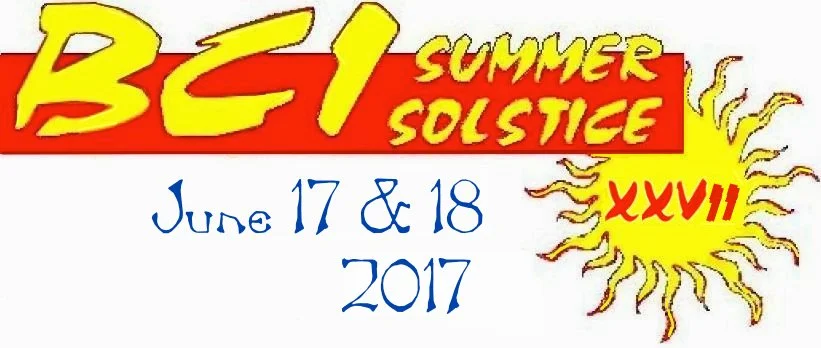
Summer Solstice Tours - For 27 years BCI had an overnight tour from Irvine to Carlsbad near the June Solstice. (June 17-18, 2017)
Here are the last 2017 routes:
Irvine station to the Motel 6 in Carlsbad
SATURDAY (Out & South) 53.6 miles +1,682 ft {CF 3 31.4’/m}
Map / Elevation
SUNDAY (Back North) 52.9 miles +1,906 ft {CF 3 36.0’/m}
Map / Elevation
RIVERSIDE county
Riverside to Anaheim Remote ( with Trains) (April 30, 2021) (Jan 28 2022)
Catch the IE/OC Line train #800 to Riverside. It leaves San Juan Capistrano at 8:11 with stops to jump on in LN/MV, Irvine. Tustin, Santa Ana, Orange & Anaheim Canyon.
Arrive in Downtown Riverside at 9:44. We ride past the famous Mission Inn & downtown, then roll over to Tio’s Tacos for breakfast. Then we’ll ride to Corona or Anaheim to catch trains home (or back to Riverside).
Ride Start: Riverside - Downtown Station
ROUTE SLIP 43.1 Miles Left column: Riverside to Corona; Right half: Corona to Anaheim
Ride to Corona-West - 22.5 miles (short cut)
Map/Elevation - Riverside to Corona West
Ride to Anaheim - 43.1 miles (full ride)
Map/Elevation - Riverside to Anaheim
Riverside to Corona or Anaheim Canyon Remote ( with Train)
(Nov 26 21) (Nov 25 22) (Nov 28, 25)
See also the 2026 FundaySunday version…
Drive to Downtown Riverside, ride past the famous Mission Inn & downtown, then roll over to Tio’s Tacos for breakfast. Then ride to Corona or Anaheim Canyon to catch the train back to Riverside. This one works on weekends & Black Friday when there is no morning train up to Riverside…
Ride Start: Riverside - Downtown Station
Route Slip (1 full page - Left half to Corona, Right half to Anaheim Canyon) 11/29/25
Ride to Corona-West -
22.6 miles +733 ft/-1,023 ft {CF 3 +32.6’/m & CF -4 -45.3’/m}
Map/Elevation - 22.5 miles Riverside to Corona West (Short)
Ride to Anaheim Canyon -
39.4 miles +1,108 ft/-1,737 ft {CF 2 +28.2’/m & CF -4 -44.1’/m}
Map/Elevation - 39.4 miles Riverside to Anaheim Canyon (Long)
Riverside-La Sierra to Tom’s; Farms then Corona or Anaheim
(Mar 18,‘22, Mar 17,‘23)
Train to La Sierra - Lunch at Tom’s Farms, Return to trains at Corona West or Anaheim
Ride Start: Riverside - La Sierra Station
2023: 2 ways out x 3 ways back = 6 options:
Routes Slips on 2 pages:
Option A: Around Lake Mathews to Tom’s Farms 13.6 +727/-403 ft
https://ridewithgps.com/routes/38813434
Option B: Over Lake to Tom’s Farms 12.9 +1,078/-754 ft
https://ridewithgps.com/routes/38813379
Option 1: Tom’s Farms to Anaheim the EASY way 32.7 +536/-1,441 ft
https://ridewithgps.com/routes/38813596
Option 2: Tom’s Farms to Anaheim the HARD way 32.4 +1,308/-2,215 ft
https://ridewithgps.com/routes/38813661
Option 3: Tom’s Farms to Corona West 13.1 +235/-712 ft
https://ridewithgps.com/routes/38813181
Ride Start: Riverside - La Sierra Station
2024: 2 ways out x 2 ways back = 4 options:
Routes Slips on 2 pages:
Option A: Around Lake Mathews to Tom’s Farms 13.6 +727/-403 ft
https://ridewithgps.com/routes/38813434
Option B: Over Lake to Tom’s Farms 12.9 +1,078/-754 ft
https://ridewithgps.com/routes/38813379
Option 1: Tom’s Farms to Corona West 13.1 +235/-712 ft
https://ridewithgps.com/routes/38813181
Option 2: Tom’s Farms to Anaheim 32.7 +536/-1,441 ft
https://ridewithgps.com/routes/38813596
Riverside La Sierra Loop ( December 17, 2021 )
See also the 2026 FundaySunday version…
Ride start: La Sierra Metrolink Station, Riverside
SA River Trail, Tio’s breakfast, Explore Old Town, Return on Victoria
Route Slip: 31.8 miles
Map / Elevation
SAN GABRIEL VALLEY
GMR (Glendora Mountain Road) ( May 9, 2020 )
Ride start: Glendora High School, 1600 E Foothill Blvd, Glendora, CA 91741 (map)
Route Slip: BCI-GMR-RIDE-2019
Ride with GPS Map / Elevation Profile /.tcx File
Come climb the famous GMR - The route will be up and back, so you can go as far as you want and then turn around and come back down.
Rose Parade Remote ( January 1, 2020 ) ( Jan 1, 2022)
Ride start: Alhambra Park (map)
Ride from Alhambra to Parade - enjoy parade, lunch & return to Alhambra - 16.7 mile ride
Route Slip
17.9 miles (16.5) +640 ft {CF 3 35.8’/m}
https://ridewithgps.com/routes/31691309
Puddingstone Reservoir, San Dimas Canyon, USBR 66 (May 14, 2022)
Ride Start: Pomona - Brackett Air Field
(about 35 miles / 40 minutes from Irvine) ⏏
Norm’s Hangar Coffee Shop serves until 2pm so stay for lunch after the ride!
Routes Slips (2 slips, on one page) (5/14/22)
Miss Donuts and Bagels, @ Bonita & D Street in La Verne
19.7 miles (17) +/-1,270 ft https://ridewithgps.com/routes/39033161
41.5 miles (17) +/-1,807 ft https://ridewithgps.com/routes/39032613
Additional short cuts are marked on the 40.5 mile route slip:
Turn around at mile 22: The Pacific Electric Trailhead to cut 13.9 miles = 27.6 miles total
Turn around at mile 24.5 X SAN ANTONIO to cut out 9 miles = 32.5 miles total
SanTa Barbara & VENTURA COUNTIES
Solvang Remote Routes (April 2025) (March 2024)
Ride start: The Hampton Inn in Beullton
18.2 miles +886 ft {CF 4 48’/m}
to Los Olivos, & return down Ballard Canyon (4 slips per page)
Map/Elevation
24.1 miles +1,240 ft {CF 5 51’/m}
to Nojoqui Falls, Folding Hills Winery, Hwy 101 to Buellton (2 per page)
Map/Elevation
31 miles +659 ft {CF 2 27’/m}
From La Purisima Mission (not Buellton) to Lompoc Surf (2 per page)
Map/Elevation
38 miles +2,394 ft {CF 6 63’/m}
to Los Olivos, Zaca Mesa, Ballard Canyon (2 per page)
Map/Elevation
41.7 miles +2,000 ft {CF 4 48’/m}
to Santa Rosa Road, Lompoc (lunch), La Purisma Mission, 246 back (2 per page)
Map/Elevation
41.9 miles +2,726 ft {CF 6 65’/m}
to Happy Canyon, Santa Ynez, & back on 246 (2 per page)
Map/Elevation
41.5 (35.5 to 51.5*) miles +1,900 ft {CF 4 45.8’/m}
to Los Olivos, Happy Canyon, Santa Ynez for lunch, & back on 246 (2 per page)
*If you ride all the way up Happy Canyon and back it’s 51.5; turn back short & it’s 35.5
Map/Elevation
70.1 miles +5,257 ft {CF 7 75’/m}
to Jalama Beach & back via Santa Rosa Road (4 slips per page)
Map/Elevation
All 8 Routes:
Ride start: Vinland Hotel & Lounge (March/April 2022)
1455 Mission Dr, Solvang, CA 93463-2915 (map)
13.9 miles to Los Olivos, & return down Ballard Canyon
Map/Elevation
17.3 miles to Nojoqui Falls, Folding Hills Winery, Out and Back (no Hwy 101 to Buellton)
Map/Elevation
18.7 miles to Nojoqui Falls, Folding Hills Winery, Hwy 101 to Buellton
Map/Elevation
33.3 miles to Los Olivos, Zaca Mesa, Ballard Canyon
Map/Elevation
43.4 miles to Buellton, Santa Rosa Road, La Purisma Mission, & back on 246
Map/Elevation
48.3 miles to Buellton, Santa Rosa Road, Lompoc (lunch), La Purisma Mission, 246 back
Map/Elevation
75.7 miles to Jalama Beach out & back via Santa Rosa Road
Map/Elevation
Ride start: La Purisima Mission State Park
(La Misión de La Purísima Concepción de la Santísima Virgen María)
2295 Purisima Road, Lompoc (19 mile drive West from Solvang)
31 miles to Surf Beach & back via USBR 95 across Lompoc, Lunch in Lompoc
Map/Elevation
Carpinteria Remote Routes (4/16/25)
Carpinteria to Ventura (Medium)
Lunch in Ventura at Mile 16.7
33.2 miles +791 feet {CF 2 23.8’/m}
https://ridewithgps.com/routes/49526488
Carpinteria Lake Casitas Loop (Long)
42.7 miles +2,540 ft {CF 5 59.5’/m}
https://ridewithgps.com/routes/49526347
Carpinteria to Ojai & back over Lake Casitas (Long Plus)
Lunch in Ojai at Mile 30
51.4 miles +2,761 ft {CF 5 53.7’/m}
https://ridewithgps.com/routes/49526339
Carpinteria to Ojai & Back (Metric Century)
Lunch in Ojai at Mile 30
61.8 miles +1,785 ft {CF 2 28.9’/m}
https://ridewithgps.com/routes/49526576
See also FundaySunday from Carpinteria to Santa Barbara
LOS ANGELES COUNTY

CicLAvias:
Meet the Hollywoods - August 18 2024
Union Station to Hollywood East & West
Route Slip (8/18/24)
Out & Back to the CicLAvia: 22.1 miles, +746 ft CF3 (23.8’/m)
Ride withGPS Map / profile
4 1/2 miles from the train station to the CicLAvia -
route follows interstate USBR 66 most of the way, but this is in LA road conditions.
We will keep the pace to stay together and be most visible in traffic.
Faster return on USBR 66
Instead of doing all of the CicLAvia both ways: it May be faster - but local traffic may be worse due to the closures…
Alternate Route Back to train station:
22 miles, +708 ft CF3 (32.2’/m) (Less CicLAvia and more USBR 66)
Ride withGPS Map / profile
Heart of LA - October 13 2024
Union Station to Downtown Los Angeles
The Route(s) (7/15/24)
Gather at the front of Union Station (West entrance) and
ride to the CicLAvia together to get there in about 5 minutes…
Route: 2,225 feet +39/-4 ft https://ridewithgps.com/routes/47582060
Get back to Union Station on your own from the CicLAvia:
From Broadway on Cesar Chavez: 2,144 feet -23ft https://ridewithgps.com/routes/47582187
From First Street on Los Angeles: 2,823 feet +19/-18’ https://ridewithgps.com/routes/47582288
See also FundaySunday from Lauries Pie Bar in Long Beach.
Out Of State
Carson City Scene (Nevada & California) (May 2025)
#01 A Ride to water fall hike 12.6 miles CF9 (96.1'/m) +1,211 ft*
RWGPS
#01 B Ride to Town 17.9 miles CF3 (33.6'/m) +601 ft
RWGPS
#01 C Ride to town and water fall 24.1 miles CF6 (63.9'/m) +1,539 ft
RWGPS
#02 Ride to Paul Schat’s Bakery 25.8 miles CF4 (43.6'/m) +1,125 ft
RWGPS
#03 A Franktown - Bowers Mansion 23.9 miles CF6 (64.0'/m) +1,529 ft
RWGPS
#03 B Franktown, Bowers, SOL Dispensary 30.7 miles CF5 (55.6'/m) +1,707 ft
RWGPS
#03 C Franktown, Washoe Lake loop 31.9 miles CF5 (52.7'/m) +1,680 ft
RWGPS
#03 D Franktown to South Reno 48.3 miles CF5 (53.5’/m) +2,586 ft
RWGPS
#04 Timberline; Add a climb to Timberline 6.4 miles CF10 (122.2'/m) +654 ft
RWGPS
#05 Virginia City loop 54 miles CF7 (77.4'/m) +4,181 ft
RWGPS
#05 Virginia City loop reversed 54 miles CF7 (77.6'/m) +4,191 ft
RWGPS
#06 Carson City Tour 22.5 miles CF3 (39.6'/m) +892 ft
RWGPS
#12 Tour de Corrections 30.1 miles CF5 (50.1'/m) +1,498 ft
RWGPS
#13 Hill Climbing “Six Pack” 16.2 miles CF13 (133’/m) +2.154 ft
RWGPS
Remote Start - Drive South to Target at 395 & Jacks Valley RWGPS
#07 A Genoa to Carson Pass Hwy & back 47.6 miles CF4 (40.3'/m) +1,917 ft
RWGPS
#07 B Across Carson Pass to Alpine & back 59.2 miles CF4 (44.5'/m) +2,637 ft
RWGPS
Remote Start - Drive South to Genoa RWGPS
#08 A Same as #07 A but shorter 30.8 miles CF3 (35.0'/m) +1,078 ft
RWGPS
#08 B Same as #07 B but shorter 42.4 miles CF4 (42.0'/m) +1,782 ft
RWGPS
#08 C Same as #08 B + Emigrant Trail 48.8 miles CF5 (51.2'/m) +2,500 ft
RWGPS
Remote Start - Drive North to Reno RWGPS
#09 Reno to Verdi (Medium) 25.5 miles CF5 (50.5‘/m) +1,287 ft
RWGPS
Remote Start - Drive North to South Reno RWGPS
#10 A Tour de Animals 19.9 miles CF6 (60.8'/m) +1,210 ft
RWGPS
#10 B Reno to Verdi (Long) 44.9 miles CF5 (50.5‘/m) +2,244 ft
RWGPS
Remote Start - Drive South West to Markleeville RWGPS
#11 A Death Ride Half Century 50.2 miles CF14 (143.7’/m) +7,215 ft
RWGPS
#11 B Death Ride w/o Topaz Lake 69.3 miles CF11 (117.2’/m) +8,122 ft
RWGPS
#11 C Death Ride Century 104.6 miles CF13 (134.7’/m) +14.094 ft
RWGPS
see "Tour of the California Alps" https://deathride.com/